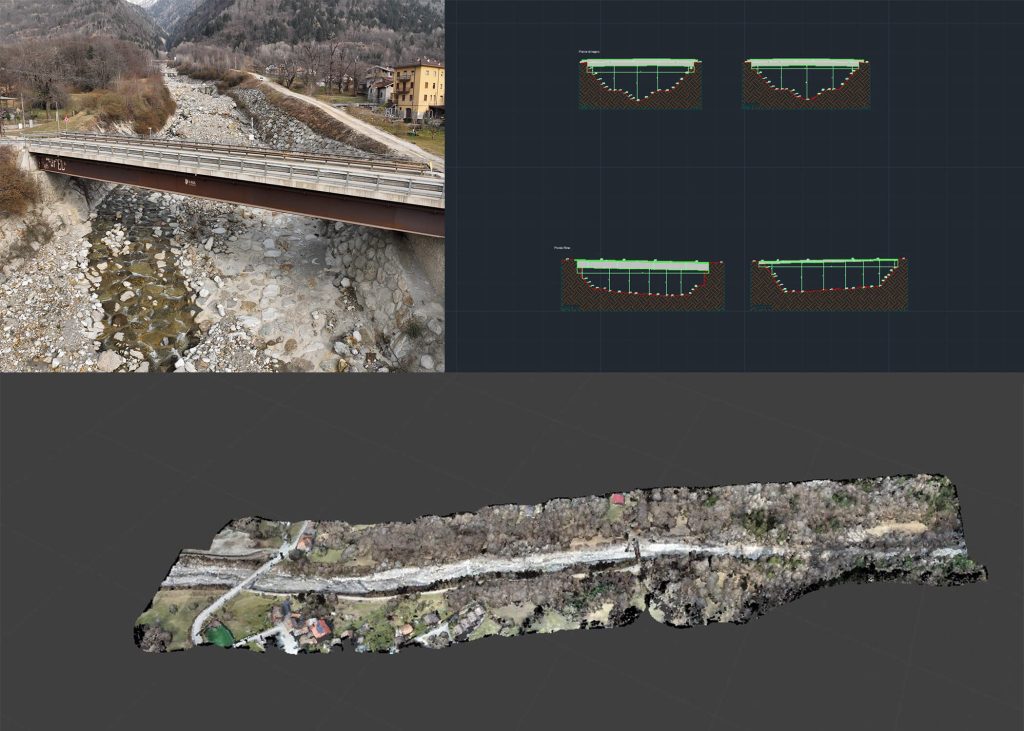
The survey work was carried out along a stretch of the Rabbia river, located in the valley of the same name, in the municipality of Sonico (BS). The overall area surveyed extends for 6 hectares, with a development of approximately 1 km.
The survey involved the restitution of the following products:
- Unfiltered point cloud of the entire surveyed area
- Digital Terrain Model (DTM) and surface model (DSM) of the surveyed area, generated with Laser Scanner technology, in TIF or GRID file format.
- High-resolution orthophotoplans of the surveyed places, in TIFF or compatible file format.
- Topographic restitution of the two crossings present in the riverbed (Ponte Rino and Ponte di Legno).