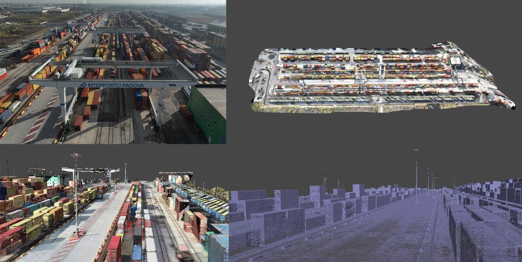
The following documents were delivered to the client: monographs of new landmarks, materialized and surveyed using different cartographic reference systems, a digital surface model (DSM) of the area surveyed with LiDAR technology, and a digital terrain model (DTM) of the area itself, again with LiDAR technology.
A georeferenced photo plan with a pixel resolution of up to 2 cm was also produced, as well as a topographic plan with the vectorization of the required elements, with the indication of the sections of the overhead cranes.
Finally, the cross-sections and longitudinal sections of the gantry cranes were created to accurately represent the overall dimensions and dimensions of the structures.