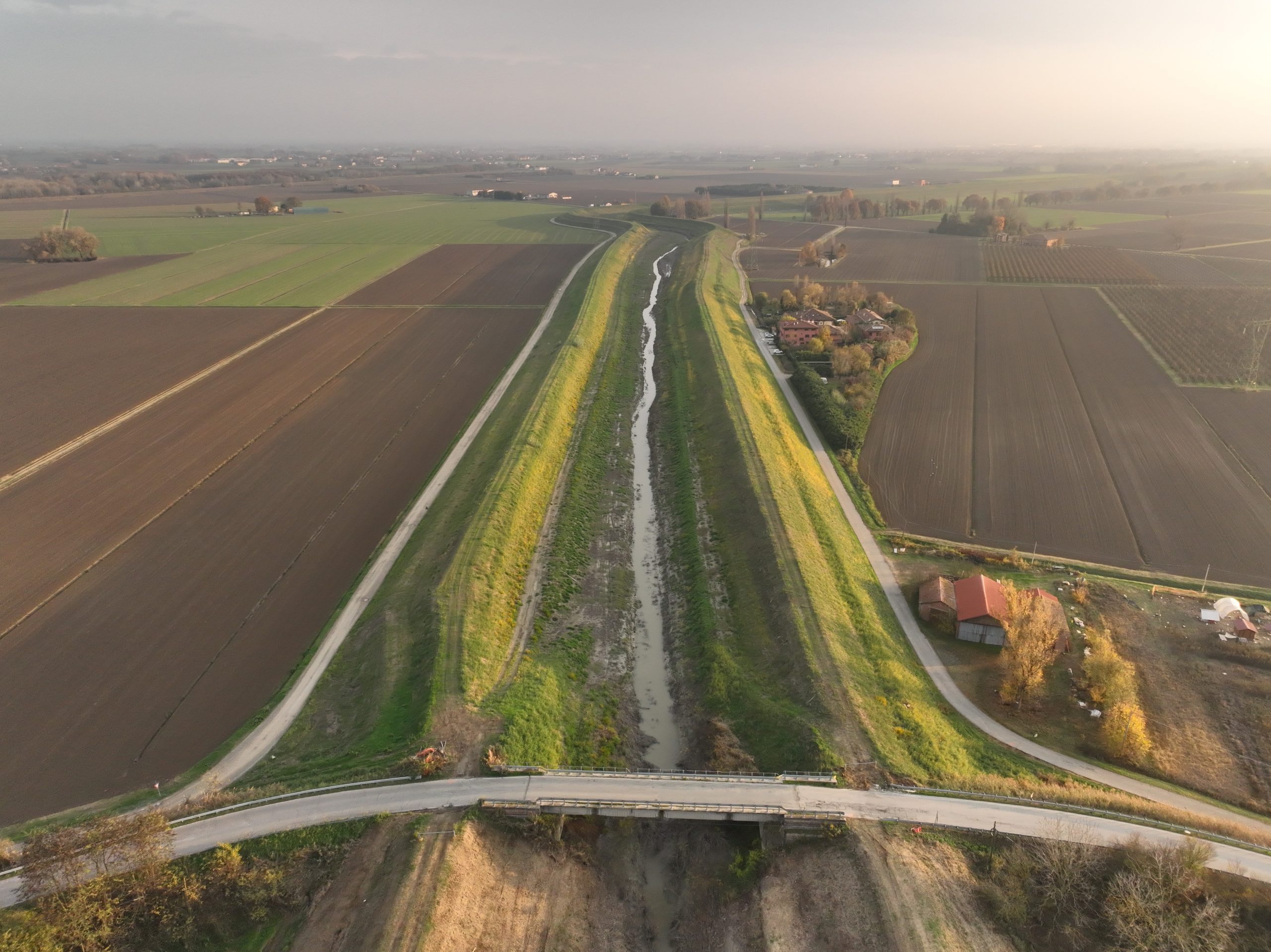
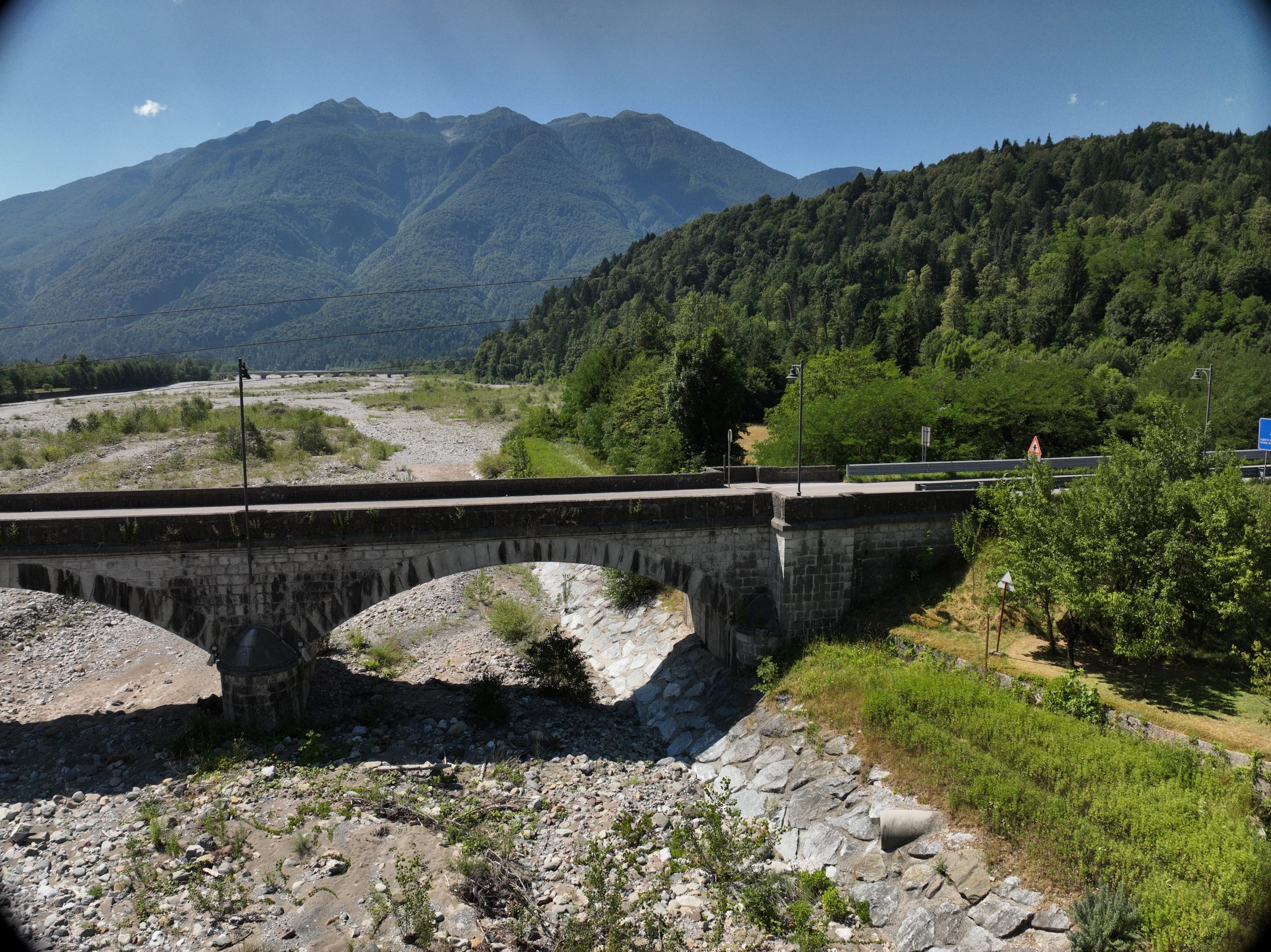
2025 | Remote Sensing Topographic surveys and aerial laser scanning (LiDAR) of a bridge and a stretch of the Samoggia stream bed Vedi Progetto
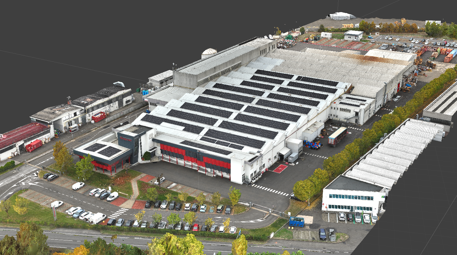
2025 | Remote Sensing Topographic and aerial photogrammetric surveys of the “Snap-On” industrial plant Vedi Progetto
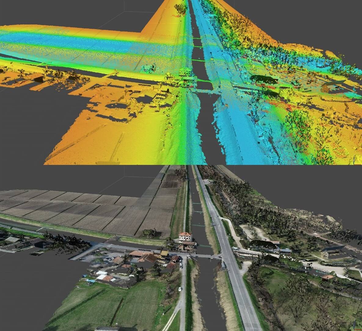
2025 | Remote Sensing Topographic and aerial photogrammetric surveys for the as-built version of a new access road in the Villapiana-Ronchena area. Vedi Progetto
2025 | Remote Sensing Topographic and aerial photogrammetric surveys to verify the as-built condition of a floodplain in Farra di Feltre. Vedi Progetto
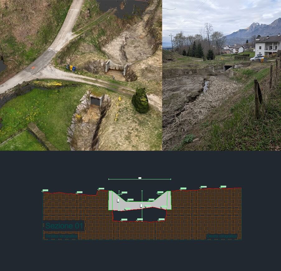
2025 | Remote Sensing Topographic surveys and aerial laser scanners (LiDAR) of hydraulic crossings and related river appurtenances Vedi Progetto
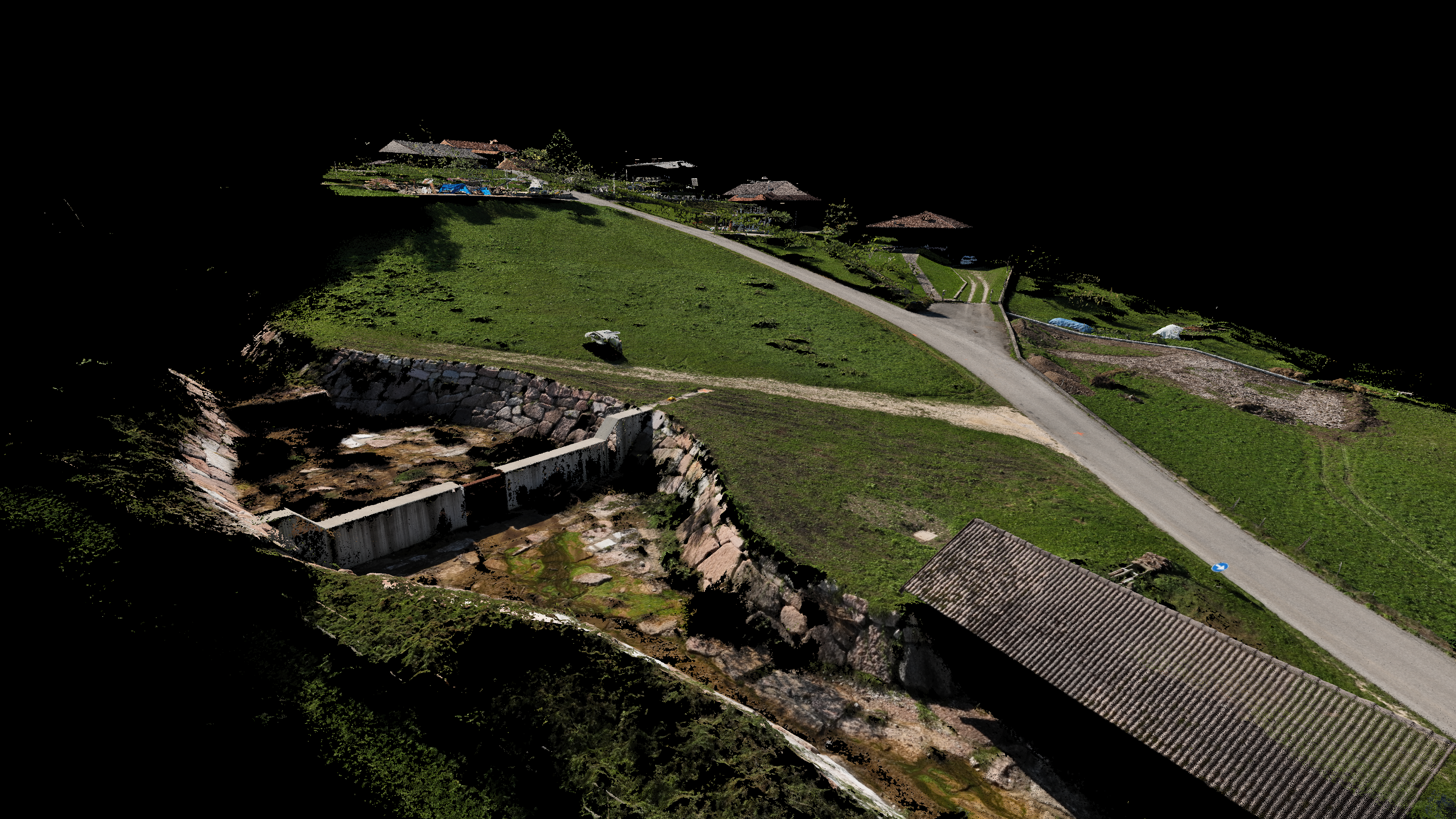
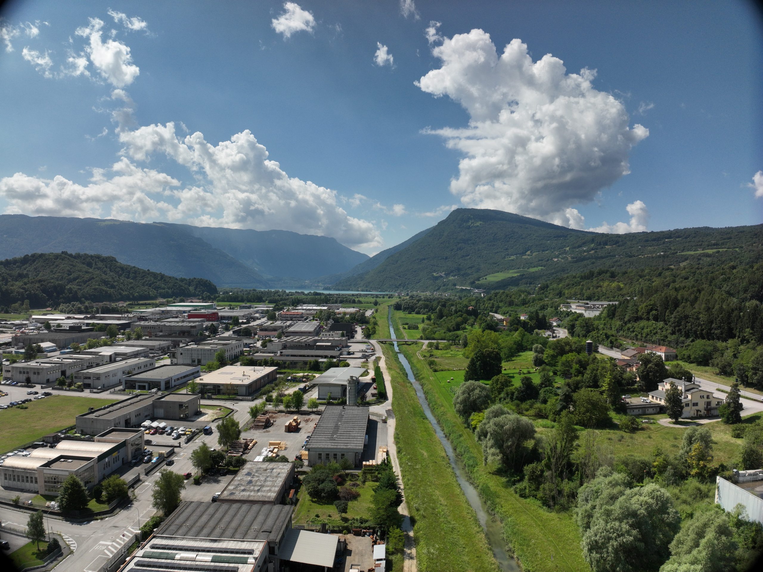
2025 | Remote Sensing Topographic and aerial photogrammetric surveys of an area adjacent to the “Corlo” lake Vedi Progetto
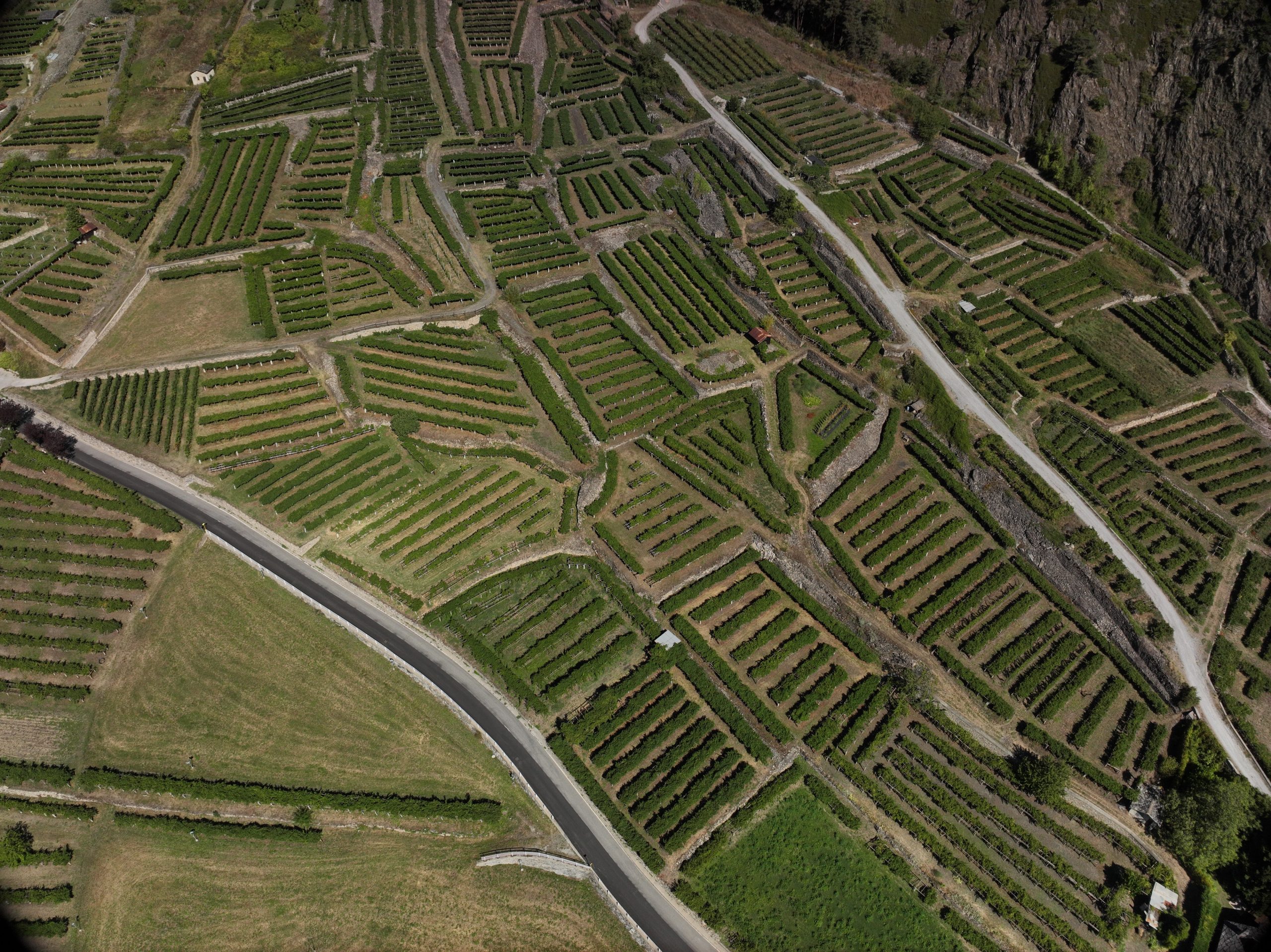
2025 | Remote Sensing Topographic and LiDAR survey of an Alpine cone located in the municipality of Morgex Vedi Progetto
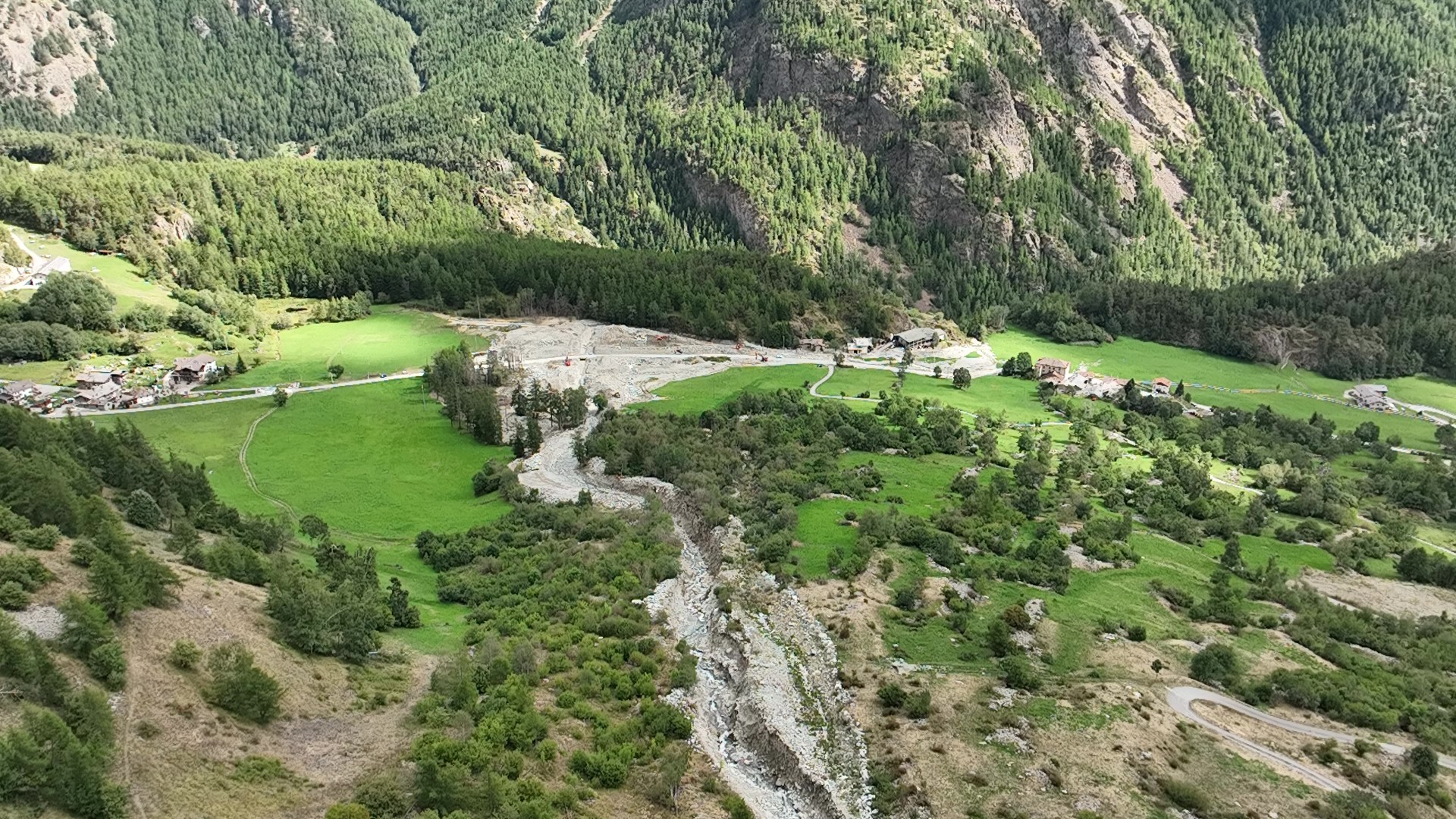
2025 | Remote Sensing Topographic and LiDAR survey of an Alpine fan located in the municipality of Oyace following a debris flow Vedi Progetto
2025 | Remote Sensing Topographic and aerial photogrammetric surveys of a section of underground pipeline aimed at the as-built of the places Vedi Progetto
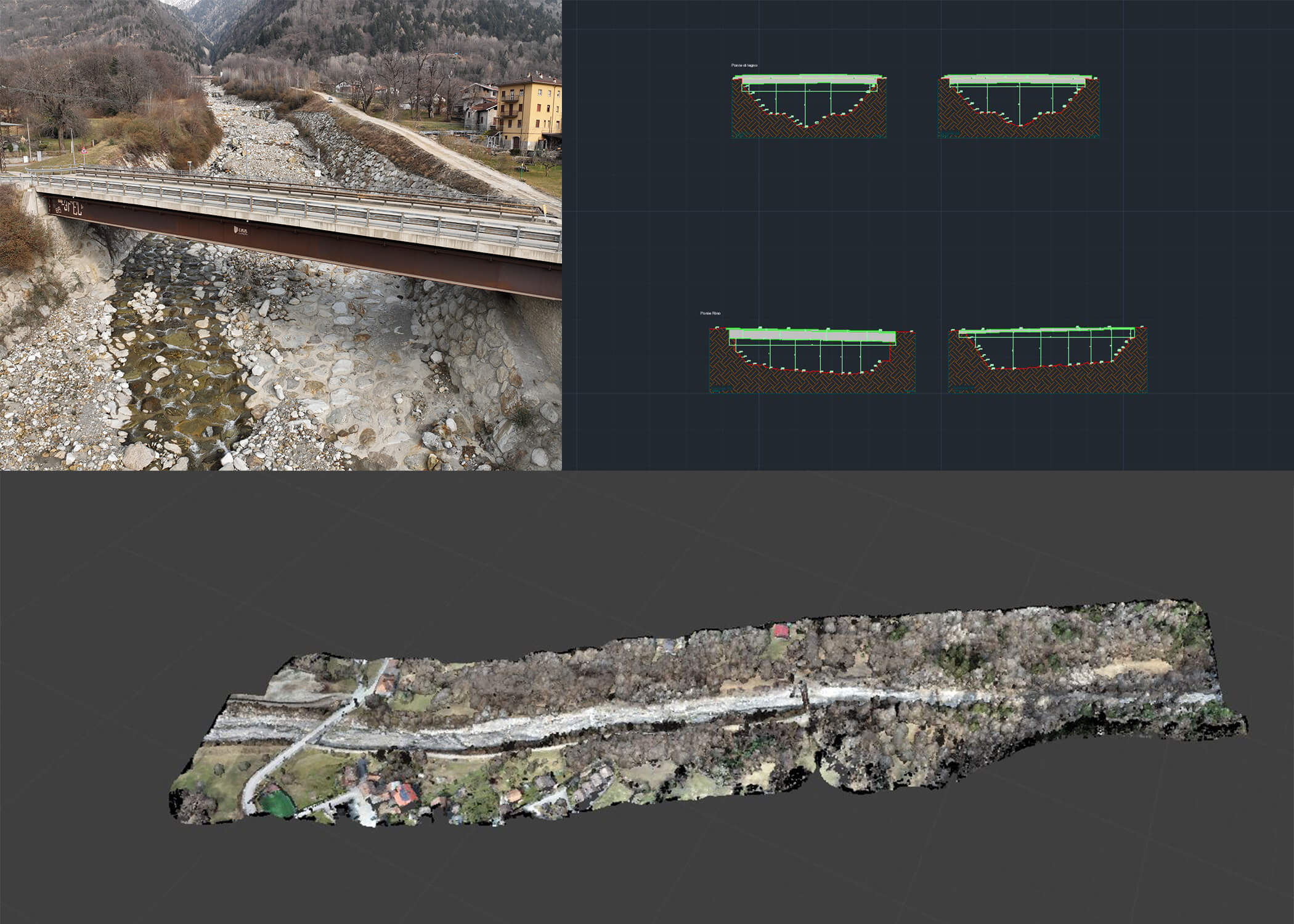
2025 | Remote Sensing Topographic and airborne laser scanning (LIDAR) surveys of a bridge and a section of the Degano riverbed in Chiassis – Lauco Vedi Progetto
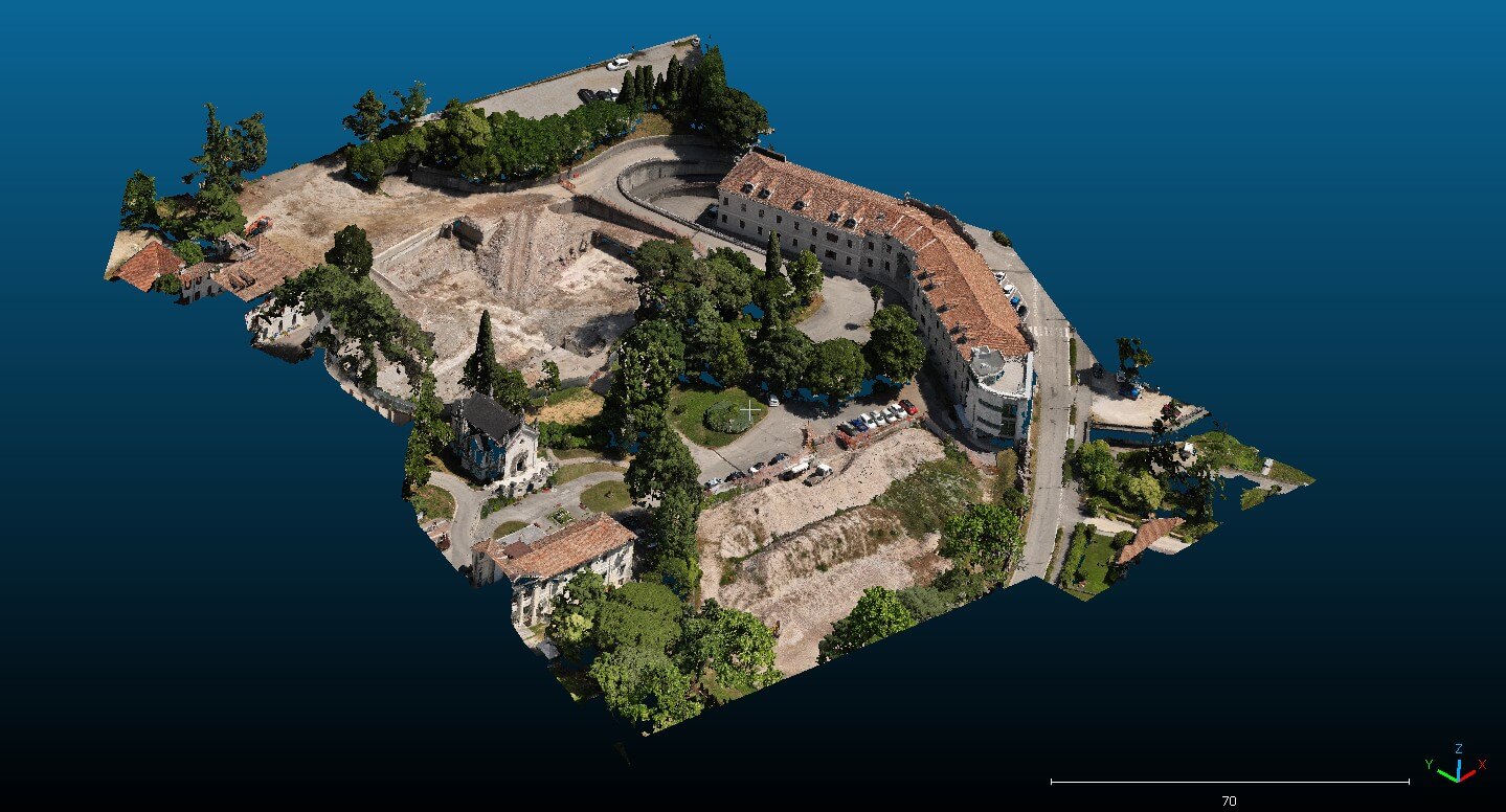
2025 | Remote Sensing Topographic surveys relating to the state of the places, post demolition of the “San Gregorio” center Vedi Progetto
2025 | Remote Sensing Topographic and aerial photogrammetric surveys along a stretch of the Landrisio river, which flows next to the Luxottica “Sedico 2” plant Vedi Progetto
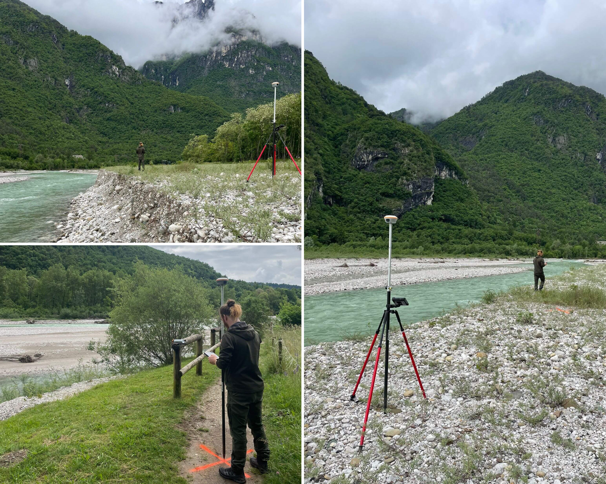
2025 | Remote Sensing Topographic surveys and aerial laser scanners (LiDAR) for a stretch of riverbed along the Cordevole stream in the Peron area Vedi Progetto
2024 | Remote Sensing Topographic surveys and aerial laser scanners (LIDAR) along a stretch of the Rabbia stream – located in the valley of the same name – in the municipality of Sonico (Bs) Vedi Progetto
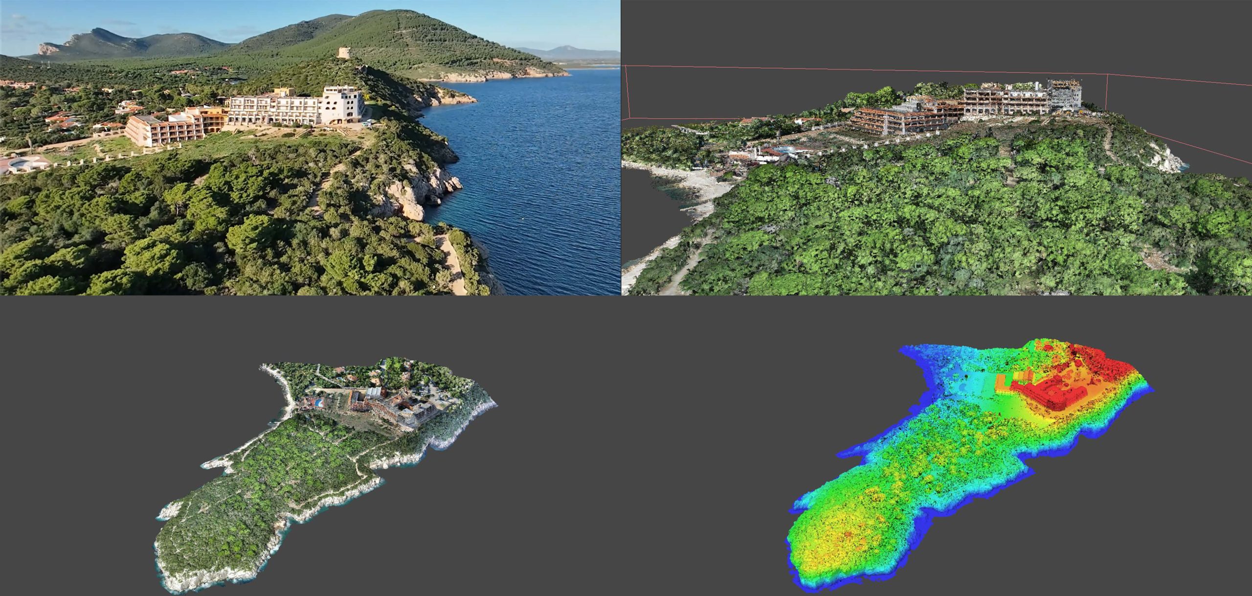
2024 | Remote Sensing LiDAR and aerial photogrammetric surveys of the residential complex “Hotel Capocaccia” (Alghero) Vedi Progetto
2024 | Remote Sensing Topographic, bathymetric and lidar surveys along a stretch of the S.S. 309 “Romea” from km 101 to km 116 Vedi Progetto