Skip to content
  • Via Prati 11 36031 Povolaro di Dueville - Vicenza
  • Tel + 39 0444 169000
  • Email: info@epcsrl.eu
Linkedin Icon-facebook Youtube Icon-instagram-1
  • Home
  • About Us
  • Sectors
    • European Projects
    • Territory and Environment
    • Remote Sensing
  • Services
    • Project drafting
    • Technical assistance for management
    • Communication & Participation
    • Financial management and reporting
    • Environmental design
    • Territorial Information Systems
    • Survey strategies
    • Laser scanner surveys
    • Aerial and terrestrial photogrammetry
  • Projects
  • News
EPC_Logo.png
Contact us

Aerial photogrammetry, LiDAR, Quarries, Remote Sensing

EPC – News 

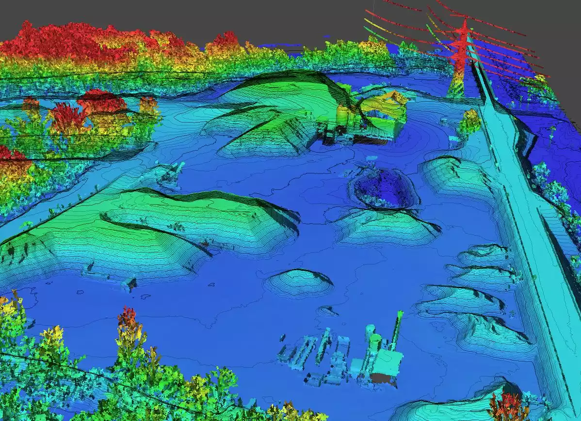
New Advances in Quarry Photogrammetric Surveying Thanks to LiDAR Sensors

15 July 2024

Quarries are now at the forefront of a technological revolution due to the increasingly widespread adoption of drone photogrammetric surveying. This methodology, already established as one of the most efficient solutions for mapping and monitoring

  • Via Prati 11 36031 Povolaro di Dueville Vicenza – Italy
  • + 39 0444 169000
  • info@epcsrl.eu

Pages

  • Home
  • About Us
  • Projects
  • Services
  • News

Sectors

  • EUROPEAN PROJECTS
  • TERRITORY AND ENVIRONMENT
  • REMOTE SENSING

Legal Notes

  • Terms of Use
  • Privacy policy
  • Legal Notes
  • Quality
  • Contact
Copyright © 2024 EPC Consulting Srl All Rights Reserved