
Skip to content
  • Via Prati 11 36031 Povolaro di Dueville - Vicenza
  • Tel + 39 0444 169000
  • Email: info@epcsrl.eu
Linkedin Icon-facebook Youtube Icon-instagram-1
  • Home
  • About Us
  • Sectors
    • European Projects
    • Territory and Environment
    • Remote Sensing
  • Services
    • Project drafting
    • Technical assistance for management
    • Communication & Participation
    • Financial management and reporting
    • Environmental design
    • Territorial Information Systems
    • Survey strategies
    • Laser scanner surveys
    • Aerial and terrestrial photogrammetry
  • Projects
  • News
  • Italian
EPC_Logo.png
Contact us

GIS, industrial hydraulic network, QGIS, Remote Sensing, risk assessment, topographic surveys

EPC – News 

Rilievi Topografici

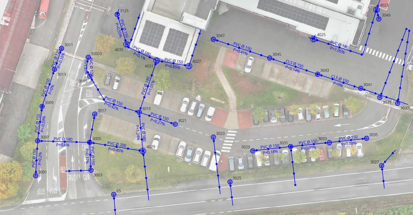
Topographic Surveys of Industrial Hydraulic Networks: A Guide to Risk Assessment

25 February 2026

Topographic surveys of water networks are essential technical activities for mapping and managing drainage infrastructure within industrial plants and production complexes. Thanks to the acquisition of precise geometric and altimetric data, these operations support risk


Laser Scanner survey by drone at the former aggregate landfill “La Vallesella” – Municipality of San Vito di Cadore

24 March 2025

In 2024, the EPC team carried out a laser scanner drone survey for the municipality of San Vito di Cadore (BL), at the former aggregate landfill called “La Vallesella.” The site, located on the hydrographic

  • Via Prati 11 36031 Povolaro di Dueville Vicenza – Italy
  • + 39 0444 169000
  • info@epcsrl.eu

Pages

  • Home
  • About Us
  • Projects
  • Services
  • News

Sectors

  • EUROPEAN PROJECTS
  • TERRITORY AND ENVIRONMENT
  • REMOTE SENSING

Legal Notes

  • Terms of Use
  • Privacy policy
  • Legal Notes
  • Quality
  • Contact
Copyright © 2024 EPC Consulting Srl All Rights Reserved