Topographic surveys of water networks are essential technical activities for mapping and managing drainage infrastructure within industrial plants and production complexes.
Thanks to the acquisition of precise geometric and altimetric data, these operations support risk prevention, proactive maintenance, and insurance assessments.
What are industrial networks?
Industrial hydraulic networks are complex systems designed for the collection, conveyance, and disposal of rainwater and process water.
A standard hydraulic network includes:
- Drains and perimeter ditches.
- Underground pipes and inspection wells.
- Accumulation tanks and hydraulic regulation structures.
Why is it important? An efficient network prevents flooding and structural damage to production assets, directly improving the plant’s insurance risk profile.
The Role of Topographic Surveys in Risk Management
Topographic surveys allow us to reconstruct the actual structure of the drainage system by measuring its routes, elevations, slopes, and cross-sections.
This technical data is essential for:
- Hydraulic Surveys: They provide an objective and certifiable basis for assessing the current state.
- Vulnerability Analysis: They allow us to reliably estimate the potential damage in the event of extreme events.
- Insurance Audits: They support the definition of coverage and the adaptation of risk management strategies.
How is a professional topographic survey carried out?
The activity follows a rigorous technical workflow to ensure data accuracy:
- Preliminary Analysis: Study of existing technical documentation and the functional characteristics of the site.
- Field Survey: Conducting planimetric and altimetric measurements, identifying access points to underground networks.
- Data Processing: Providing detailed, certifiable mapping for expert assessment purposes.
What is the purpose of surveying the hydraulic networks of a facility?
It is used to precisely map pipes, slopes, and structures to prevent flooding, manage maintenance, and provide reliable data for insurance appraisals and hydraulic risk analyses..
What tools are used to process topographic data?
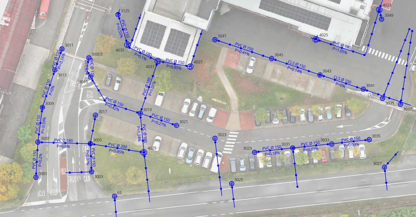
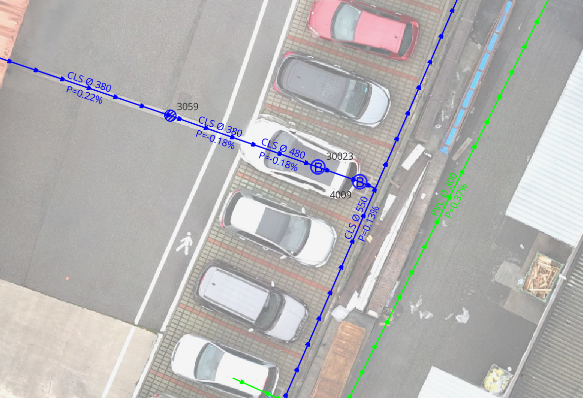
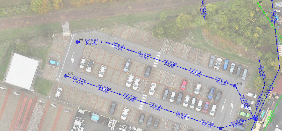
GIS software, such as QGIS, is used to integrate field data to create technical maps, hydraulic profiles, and functional diagrams necessary for audits and technical assessments.
GIS Integration with QGIS Software
In 2026, QGIS will be the standard for processing topographic data. This software allows you to:
- Identify critical issues related to discontinuities or incorrect slopes.
- Produce technical maps and hydraulic profiles for risk audits.
- Provide data-based decision support for risk mitigation.
The Foundation of Risk Assessment
Topographic surveys are the cornerstone of hydraulic risk assessment.
Only through detailed knowledge of infrastructure geometries is it possible to define effective mitigation interventions and protect the operational continuity of industrial facilities.
EPC – European Project Consulting has been performing topographic and aerial photogrammetric surveys for twenty years. If you’d like to learn more, click this link.